
APB SouthProperty Due Diligence
← Command Center
Takeover Readiness
Full physical, legal & operational assessment of the ~25-acre Stock Island facility, organized for a zone-by-zone phased takeover — not a clean sweep. Live-aboards transitioned, derelicts triaged, then docks, power & buildings rebuilt one phase at a time. Everything here is editable and saves locally; export the data when it's time to move it to the shared login site.
Deep links, pre-aimed at the property where possible. Use these to capture the folio, assessed value, zoning, flood zone, permit history, and the submerged-lands lease.
Live Google satellite, centered on the facility. Loads when the hub is served over the network (localhost:4100). Use the ↗ links on the Property tab for full-screen Google Earth / Bing aerial and to trace zone boundaries.
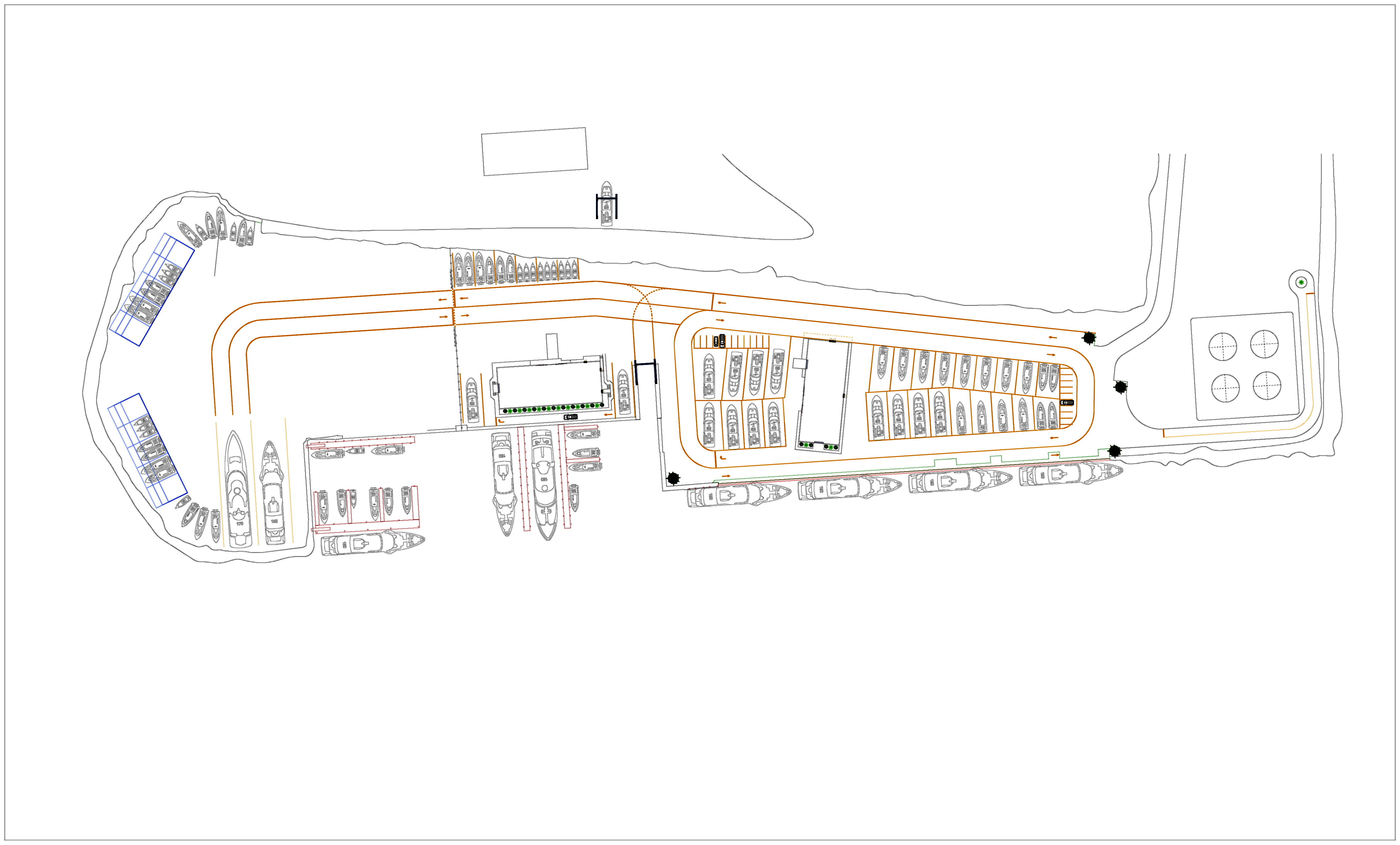
APB's own survey of the basin, finger-pier slips, seawall/bulkhead (green) and upland yard. This is the base map for drawing the phase zones and slip-by-slip vessel/condition assessment.
Utility: Stock Island / Key West is served by Keys Energy Services (KEYS), the public power utility for the Lower Keys, fed from the Stock Island substation & generating facility. Capture the service specs below, then confirm available capacity directly with KEYS Commercial Service before sizing any dock-power rebuild.